
Wetland Discharge Monitoring
City of Issaquah


Location
Issaquah, WA
Service
Environmental, Stormwater
Surface water discharge from a wetland in the Issaquah Highland Annexation Area was measured during the 2011 water year to evaluate the hydrology of the wetland prior to proposed development in its watershed. This background hydrologic information will help the City analyze the potential impacts of proposed development within the wetland’s drainage basin. It will also allow for evaluation of potential stormwater design and management options to maintain the existing wetland hydrology and riparian habitat.
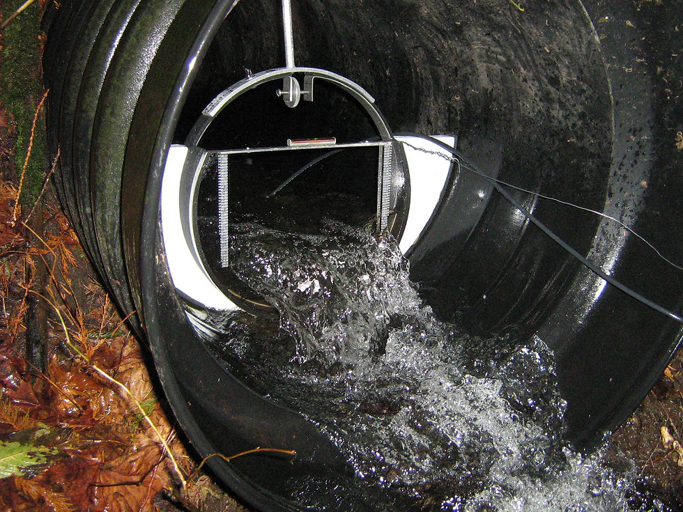
RH2 performed a reconnaissance of the drainage basin to determine the best monitoring location, which was identified as a 2-foot-diameter culvert located near the point where the creek gradient steepens as it drops into the valley toward the East Fork Issaquah Creek. RH2 worked with the Washington State Department of Fish and Wildlife to obtain Hydraulic Project Approval for installation and maintenance of the weir in the stream channel.
RH2 staff deployed the monitoring equipment, which consisted of a Thel-Mar Brand weir and a pressure transducer data logger. The setup allowed for the stage to be recorded every 15 minutes throughout the study period. Stage was correlated with discharge by manual measurements taken on the weir over the course of the year.